Monday, May 30, 2016

Shades State Park Run (Saturday)

Saturday in Indianapolis is always a day with nothing going on.  Last year, I found a really cool State Forest.  It had nice singletrack and more elevation than I expected.  I heard about another nearby place, Shades State Park.  An online friend used to live near there.

I arrived around noon.  It was warm out, so I went with a singlet.  I figured my vest might make me a little hot too.  The singlet ended up being a good choice.  It was cool in ravines, so I was comfortable most of the time.

I had no actual plan.  This is a bunch of short trails.  The longest was only 1.25 miles.  I took a map, but I just headed off.  I started off at the Devil’s Punch Bowl, near the parking lot.  After going over some wooden steps, I was down in there.

This area is terrific, like much of the stuff in this park.  Streams have carved their way through the rock and made ravines.  There are massive rock layers that you run along.  This was so stunning.  I haven’t been in terrain like this yet and didn’t expect to encounter it in the lands of farm fields in Indiana.

There were a few hikers in this area.  This trail led to a waterfall, but then you had to climb back up.  It was pretty well maintained up above.  There was an overlook, but it had too many trees.

Next, I headed to a few more of the numbered ravine trails.  First, I went downhill again.  This part was equally as beautiful.  The upper portions had the rock walls.  Below that, the trail was a flowing stream.  My feet got very wet and muddy.  Some young guys were impressed that I was running down it, as the moved out of my way.

This one had a ladder down.  The next trail I took from the bottom to the top.  It had a couple ladders up.  I followed some people, but stopped for too many pictures.  The scenery was stunning.  At the bottom, there had been a stony beach and stream too.

There were a few waterfalls, but they were small.  Above the ravine, it was on to smooth, wide trail.  I ran past a group of people.  I didn’t know where to go, so I just followed the signs to Trail #7.  That was a fun and easy descent.

This looped around and Trail #8 came off of it too.  This was labeled as “rugged.”  Rugged definitely was a good term, as all of these trails had rocks, mud and water.  Families could take them, since they are short, but they are definitely better for experienced hikers.

I ended up climbing up #8.  Even at this point, I was only around 3 miles or so.  The terrain was slowing me, as was the photo taking.  There was a significant elevation change with each one of these ravines.

I now had been mostly everywhere.  I wasn’t on Trail #2 yet though.  This one looked like an amazing loop.  I went on Red Fox Ravine, which had some smooth rocks with a stream.  I saw a raccoon.  He looked at me before taking off.

I came to an intersection.  Some hikers were also looking for Trail #2.  We eventually got our bearings.  I told them I was running, so if we weren’t going the right way, I’d be turning back toward them.  I found Trail #2 after a parking lot.

There was some nice running before hitting the loop.  However, I couldn’t run the slight uphills much.  I was hot and tired.  I looked at the map and realized I wanted to run down the ravine.  So I ran the loop counterclockwise.  I think this ended up being a good choice.

Much like every other ravine, this one didn’t disappoint.  This was probably the best one yet.  There were rock walls everywhere.  I felt like I was at a canyon out west.

I heard voices as I climbed over some rocks.  There was a family with two little girls.  I maneuvered around them, but it wasn’t easy.  This was my favorite part of the whole day.  The trail was singletrack sort of along a ridge.  The trail went underneath a cliff though.  A small waterfall was next to it too.

There was a trail straight ahead, but stairs down.  I figured the trail must be down the stairs, but I was unsure for a lot of the way down.  It was mostly just a stream bed.  Every now and then, I found the actual trail.

I only knew I was on track when I finally saw a family coming up.  I was near the bottom at that point.  That climb up would be interesting for families.  At the bottom, there wooden steps up.

These were exhausting to climb.  However, I was glad I didn’t run down them.  That would’ve been boring.  I saw a young couple, with the woman wearing flip flops.  Then, I saw the two guys that were lost earlier.  I told them it was awesome, but they had a tough climb up.

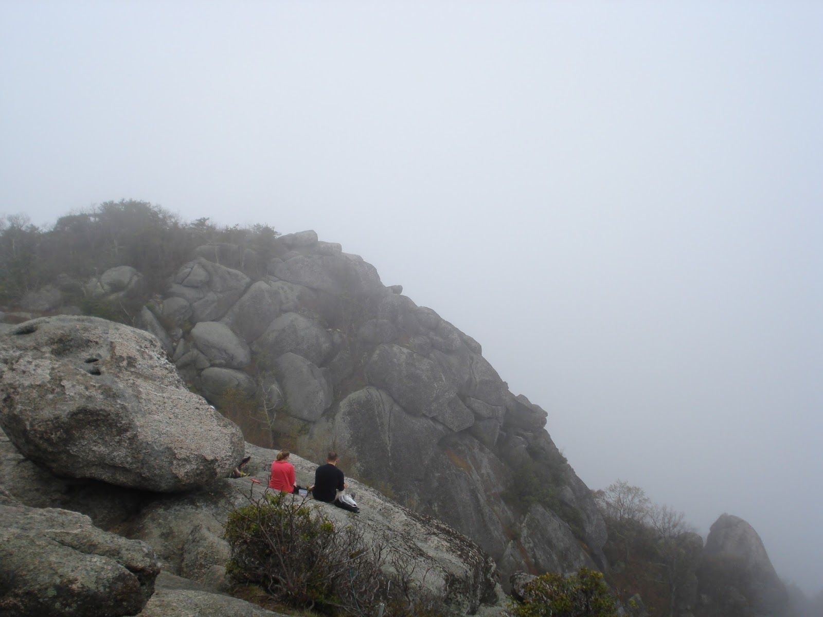
I finished the loop and went to Lover’s Leap.  This viewpoint had trees blocking it too.  I headed back and finished up this loop and was out at the parking lot.  I checked the map and found a shorter way back to the car.  A bunch of youths were hiking down to Devil’s Punch Bowl.

I got back at my car.  Again, I was around mile 6, like the other day.  It was good to be done.  This was a slow day, but it was stunning.  I never thought I’d see something like this in Indiana.  I was impressed.


I will be at the race tomorrow and traveling home Monday.  If it is a nice day, maybe I’ll run then.  If not, I’ll probably do so on Tuesday.  I’m still not sure when I’m leaving for Colorado yet, but it will likely be in early June.

6.04 miles - 1:50:23 (18:17 pace) 547 feet of elevation gain 

Indianapolis Motor Speedway Run (Friday)

Not surprisingly, I haven’t run much lately.  I did put in 36 miles of backpacking over the weekend.  Today, I managed to get a run in.  We are at the Indianapolis 500.  I wanted to trail run, but I didn’t have the energy to drive anywhere.  Instead, I hit the roads for the first time in months.

I almost didn’t at all.  I started at about 7:30 PM, from the campground.  It was still hot and humid.  I wore shorts and a short sleeve shirt and was sweating a lot early on.

I headed along the frontstretch of the speedway.  That was cool for road running at least.  It’s about 1/3 of a mile to where we’ll be sitting on Sunday.  I then, headed to the town of Speedway.  They have a cool Main Street, with bars and such. 

This area was a little busy.  I ended up getting over a mile into the run at the end of the street.  I dodged people, but did okay.  The plan was for only about 4 miles.  I decided to turn right and run through the town. 

This road was nice at first, but then became busy.  I ran out of shoulder, but had a bike lane to run on.  I felt like I was paralleling Crawfordsville Road, but I guess I wasn’t.  I got over mile 2 and kept going.  I knew I’d need a little farther to do a loop.

When I was ready to turn, there was nowhere to actually turn.  There were a couple dead end apartments.  I finally turned down a road and found some cool wooded houses.  This road went nowhere then.

Eventually, I found a busy nearby road that seemed to head in the correct direction.  This was wooded and went on and on and on.  I checked off the road for dead bodies.  At times, I even lost the shoulder.

I figured I was going the correct way, but unsure.  I was going next to the highway, so I figured my direction was good in general.  I then came to a T-intersection.  I took a right on to 22nd Street.

I was around mile 3 now and clearly would be well over 4 miles for the run.  I thought I had a rough idea of where I was, but then 22nd Street ended too.  I went right again.

I now had no idea where I was.  However, I could see the street signs were the same as those in the town of Speedway, so at least I was on track.  I followed this road more and more.  After a curve, I saw what I thought was Crawfordsville Road.

It turns out this was actually Lynnhurst Road, but that is by the track too.  At least I knew where I was now and how to get back to the camper.  I took a left and continued on through.  I then made the right on to 20th Street.

I was now just a few blocks from finishing up.  I cruised on in to the campground.  I was approaching mile 6.  Amazingly, I basically hit that point right at my camper. 

I was sweaty and sore from doing more road miles than I’m used to.  However, I got the run in.  It was good to get out there.  I added miles without getting totally lost, so I can’t complain. 


I’m probably not going to run again until Saturday.  I have no mileage plan for that.  I’m hoping to run at Shades State Park.  It is supposed to be a cool place.  It is an hour away and I think a $9 entry fee, so we’ll see what I decide.

5.99 miles - 56:31 (9:26 pace) 59 feet of elevation gain

Wednesday, May 18, 2016

A Rare Mt. Minsi Trip

I typically go to Mt. Tammany all the time.  It has been a long, long time since I stayed in Pennsylvania and climbed Mt. Minsi.  I decided I would do that today, as well as hike around afterward.  There were some resorts there and I wanted to look for ruins and such.

The weather was really perfect.  Of course I was sweating plenty, but I couldn't complain.  It was cloudy some times too and even chilly.  Shorts and a short sleeve shirt were great.

I began by following the AT.  First, it is an old road alongside Lake Lenape, which used to be near a resort.  Then, it goes back into the woods and on to singletrack.

I saw a few young girls hiking early on.  This area is much less crowded than across the river.  It wasn't too long until I was to an awesome view.  Partway up the mountain, you can see out toward Mt. Tammany and the Delaware River.  I stopped for a bit.  I was only a couple hundred feet up at this point.

This trail is just so stunning.  It is much more green than across the river.  There is Mountain Laurel everywhere.  I bet it is awesome when blooming.  The trail has some rocks, but it is smooth in spots too.  That is probably because it has been used for hundreds of years.

This climb is so gradual.  Having poles helped too.  If I tried really hard, I might be able to run most of the climb.  Today, it was a mix of running and hiking.  The trail curves around the mountainside at times too.  I passed a cool waterfall.

I do remember the one steep section.  It was hard to run when cramping at the DWG Fatt Ass.  The trail did get steeper toward the top, but it was never bad.  I saw a backpacker near there.

There's a pretty sweet overlook at Mt. Tammany.  I forgot that part.  It is only a partial view, but it is pretty good.  A backpacker and day hiker were both in this area.  I continued on.

A short while later, I was at the Mt. Minsi summit.  That has a nice viewpoint to the south.  I looked out and tried to find the PP&L building or Lehigh's Mountaintop Campus, but had no luck.  It was cloudy.

I was around 2.5 miles.  I decided to head on the woods road for a short bit before turning to head back down.  I knew it would be fun going back.  I walked every now and then over rocks, but for the most part, I was running.

I passed a backpacker at a bad spot.  I saw the dayhiker later.  Toward the end, I passed the other backpacker.  Still, the trail was relatively empty.  I had fun running down and it was just so beautiful.  I should run here more often.

It was a quick way back.  I finished up right at 5 miles.  I got a solid 1000+ feet of climbing in too.  I really enjoyed hiking around afterward.  I found a cool waterfall that dropped about 15 feet.  I also saw some resort ruins.  I'll have to explore that area even more in the future.

I doubt I'm running tomorrow.  I won't be running for some time actually.  I'm hiking the AT all weekend.  This will be my first backpacking trip.  It should be fun.  I've been doing so much preparing of gear tonight.

5.01 miles - 1:20:48 (16:08 pace) 1015 feet of elevation gain

Monday, May 16, 2016

Angie's First Time at Tammany

I've been slacking yet again.  After running last Monday and Tuesday, I had not run since.  Some I had legit excuses.  Other times, I just slacked.  I needed Angie to keep me in check.  I didn't work, so we went up to Mt. Tammany for Angie's first trip there.

The weather was kind of tricky.  It was super windy and chilly in those parts.  However, I knew it would be warm for a lot of the run.  That was the case.  I had my shell and was sweating a lot, but also chilly a little too.

We headed up the loop.  I told her we could run the bottom, but not much else.  We ran up to the first rocky section.  Then, it was time to hike.  She has a 50K this weekend, so we were taking it easy.  Her family was there a few weeks back and she couldn't believe they hiked the whole thing (sort of).

The climb was a little tough for me just because I'm rusty.  I used poles though and that probably saved my back a lot.  I may have to train with them more often and especially race with them if I ever do race again.

There were a few hikers that we passed.  Since it was Monday, not many were out.  We stopped briefly at the lower view.  It was time to keep moving though.  We chatted and the run or rather hike at this point, flew by.

It wasn't too long until the top.  It was slower than I normally do, I think.  Some people hiked to the false summit, so we were able to pass them, since I knew where to go.  We didn't see any bears or wildlife at all.

We stopped at the bottom of the overlook for quite a few photos.  Then, it was on to the Blue Trail.  I let Angie lead.  She started running, but I didn't feel like running the ridge, so I hiked.  Then, she hiked too.

One issue is I can never eat lunch before we run.  Therefore, I was low on calories.  I had some old GU Chomps that I ate and they seemed to help.

Before we knew it, we were on the rocky descent.  I told her we could start running down now.  We passed a couple more people.  I love this part.

At one point, I was feeling good on the technical terrain.  I went ahead of Angie and went at my own pace.  I was in the zone.  She played it more cautious.

I know I'll eventually fall here and it will likely be nasty.  I rolled my ankle pretty bad, but it didn't hurt.  I bet if I wasn't so well conditioned, I would've hurt myself.  I was all alone now.

I kept thinking Angie might catch me on the smoother stuff at the bottom.  She continued to be cautious.  I cruised down quickly.  I passed a young guy in army gear.  I slipped on some loose rock there and almost fell.

I waited at the bottom of the Blue Trail.  Angie came by about 3 minutes later.  We took some waterfall pictures.  Then, we continued on.

I wanted to run a little more.  We still had time, so we headed up the AT a bit.  This was hiking early, but less steep, so we ran a little here and there too.  The army guy asked us about the route to Sunfish Pond.  We didn't have time to get there.

I wanted to get to the curving section in the hollow.  We did that and were running.  Then, we turned around to head back.

Running back was fun.  It was all downhill.  It was mostly smooth.  Angie led the way and I cruised along.  We probably ran about a mile or so to finish up  It was over 5 miles and a solid run with some nice gain.

It was good to get back to Tammany.  It was also good to show it to Angie.  She enjoyed it, except she's not as crazy about the technical descent as I am.

Tomorrow, I'm going to the doctor.  I doubt I'll run.  I should get out there more though.  I hope to backpack this weekend.

5.16 miles - 1:35:39 (18:33 pace) 1562 feet of elevation gain

Tuesday, May 10, 2016

Musconetcong Gorge Again

I was at Musconetcong Gorge to hike and enjoy nature on Sunday.  It was lovely, so I decided I'd invite people along this evening.  No one said they were coming and no one did, so I was on my own.  I didn't want a lot of miles.  I figured I'd do the loop on my own and maybe the out and back.

It was actually a nice spring evening.  Even with shorts and short sleeves, I was still sweating.  The climbing got me working hard.

I started from the lot and headed up first.  This was fun in the beginning.  I thought I was running nice and easy and cruising along.  It wasn't long before I had to work at it though.  There's some good climbing and plenty of rocks.

I was able to run most of the way to the waterfalls on this upper trail.  Then, it was too steep.  It's basically straight up out of there.  It was a mix of running and hiking and a lot more hiking.  It would take a lot of effort to keep running here.  I probably could, but I sure would wear myself down.  It is also quite rocky.

The trail kept seeming to go up.  Finally, it got a little better after the big rock.  Still, there were some little ups and downs along the ridge.  I continued on past the white blazed trail. 

I wanted to run all the way out to the road.  I figured I would stay on the trail unless it descended too much.  This ridge part is much less used.  There were still a lot of leaves and footing was tough on the narrow singletrack. 

After less than half a mile, the trail began to descend too much.  I decided to just turn around and head back.  I was only around 1.5 miles.

I came to the white blazed trail.  Now, it was time for the fun switchback descent.  It was about 500 feet in around half a mile.  I had fun cruising down.  It is a little technical and steep in spots, so I didn't push the whole time.

After getting to the bottom, there's some gradual climbing.  I was around 2.5 miles.  It wasn't long and I was at the waterfall on the bottom trail.  I took it in briefly, but kept running.  I hiked a little after the waterfall, until I was on the ridge again.

Now, I had some ridge running, as I worked my way to 3.5 miles.  I knew I had some tough climbing to go.  I kept pushing myself, but wasn't able to keep going.  I hiked a bit near the end.  This was a short day, but some fun and pretty good elevation.

I want to run here with Angie some time.  Maybe next Monday.  Tomorrow, I'll probably take off.  Maybe I'll run on Thursday.  I should do some repeats again at the Delps Trail.  I'd love to get over 4K of gain.  That would make for a long day.

3.62 miles - 48:12 (13:19 pace) 560 feet of elevation gain

Monday, May 9, 2016

Wind Gap AT w/ Angie

I've been slacking off big time lately.  I haven't run since Shenandoah last weekend.  I refused to run in the rain.  Sunday was nice, but I still only hiked.  Angie asked me to run last Monday, but I didn't see it since I was offline.  Instead, we ran this week.  She's running World's End, so she needs some trails.

We decided to meet at Wind Gap to get on the AT.  She has never run there.  That would give us some elevation and rocks without killing either one of us.  I rushed to get there and had no lunch.  She drove us to the trailhead and we set off.

It was a nice day in the low 70s.  However, it hasn't been that warm in some time.  I was sweating a bit during the run, especially since I had on my UD pack.  A slight breeze did help.

We began by heading southbound first.  We crossed the road.  Once we got on the trail, I told her to lead.  It was her run.  I also told her that it is hard to run the switchbacks on this part, but it is runnable.

She began running, but did hike a little early.  We ran a good portion of the way up.  We passed a hiker at one point.  We stopped at the overlook to the north.  Then, we continued on, over some rocks.  Another guy was at the south overlook, so we kept going.

Now, we were on the rocky ridge.  It was pretty runnable and I followed behind.  I remember when I used to think this was really technical.  It can suck, but it isn't as bad as it used to be.  It is just slow.

Angie was leading the way and kind of killing me.  I wasn't strong thanks to having no lunch.  I did drink some Tailwind, but I'm not sure enough.  I continued to try to keep up, but it was a struggle.

She finally took in some calories before mile 2.  I then caught up, but was dead.  We decided to just head back.  We came to a hiker we saw earlier.  He had on a full pack and his dog had on another pack.  It was cute.

We cruised along pretty easy.  We stopped for some photos at the overlook.  I told her that I made a Strava segment for the downhill and she took off.  I tried to keep up, but it was too much work.  I didn't want to fall, so I played it safe.

She cruised well ahead.  I had been staying even, but since I couldn't gain ground, that was enough for me.  It was so fast of a descent that I set a PR and even the 2nd fastest segment to date.  She was flying and crushed me and got the course record by over 30 seconds.

We stopped at her van to refuel a bit.  She just wanted some hiking, so we hiked up the other side.  That made chatting easier.  This part is steeper, but hiking made it better.

A little past the top, we decided to turn and mostly hike down.  I would've liked a little more running, but I couldn't keep up with her anyway and she preferred to hike.  We hiked down past the guy we saw earlier.  We finished up at the car, under 5 miles.

It was a fun day.  I always enjoy Angie's company.  I don't run with others very often, so it is nice.  I wish I felt stronger.  The layoff hurt for sure.  I should get back into better shape before Colorado.

I will run again tomorrow.  The plan is to run the Gorge in New Jersey.  I set up a run for tomorrow evening, but not sure anyone will go.  I may hike earlier in the day too.

4.8 miles - 1:33:45 (19:33 pace) 1,081 feet of elevation gain

Sunday, May 1, 2016

Old Rag - Shenandoah National Park (Saturday)


Yesterday at Shenandoah was fun.  This day would be so so.  More crappy weather was here today, in fact it was even worse than yesterday.  The plan was to climb Old Rag, the most popular hike in the park.

I wore shorts and short sleeves for most of the run.  I was slightly chilly.  Toward the end, it rained a bit more and I wore my shell.  It wasn’t great conditions, but I survived.
 
I started around 9 AM.  I knew this would be a light traffic day with the weather.  However, I was surprised to see only two other cars in the lot.  One was a guy with a huge pack.  He hiked out shortly before me.

I sort of knew where I was going, but I didn’t have a full map of the area.  I’d be following Old Rag Fire Road.  At least it was a fire road and would be kind of fast.  It was wide and pretty smooth.  I ran past the guy early on.  He was the last person I’d see for miles.

Most hikers start at the bottom, not off of Skyline Drive.  Still, I was surprised to encounter no one on the way down.  It was easy running and mostly downhill, but that was the only positive.  It was boring as hell.  I saw a sign a couple miles in that said 4.9 miles to the summit.  I toughened it out.

These miles weren’t too bad.  Not as bad as later on would be.  There were woods around, but not much to look at.  It was foggy and at times rainy.  I finally saw a nice dirt path around a turn and it was the way up to Old Rag.  I noted my elevation was around 1900 feet, so I had dropped well over 1,000 feet.

I mostly just hiked up.  There were several groups coming down.  I’m sure today was much better than most days in terms of people.  It was smooth for a bit and then started to get rocky after a shelter.

My back was feeling a bit sore.  I tried to enjoy the climb, but it was tough.  I had 400 calories of Tailwind, but probably not enough.

This climb never got hard, so as I suspected, I was taking the easier path up.  I went by several groups of college aged or 20 somethings.  They had a few cute girls.

Finally, after about 1200 feet of gain, I arrived at the summit.  All you could see was the part of the mountain next to you.  I had hoped maybe the fog would clear by now or we’d be above the clouds, but that was not the case.

The summit is massive boulders and people were sitting everywhere.  One guy asked me if I ran up.  I said, “mostly just the downhills.”  I stayed a bit, but with nothing to see and 6.5 miles and 1 hour and 30 minutes down, I had to get moving.

The “rock scramble” was the other way.  I really wanted to try it, but the loop seemed longer.  I couldn’t risk it, as I was going far no matter what.  If it added 1 mile that would’ve been no big deal, but 4 miles would’ve sucked.  Also, I wasn’t sure how much singletrack there would be and it could be very slow.

I turned and headed the way I came.  At least I knew what was up ahead.  What that was was a horrible gradual climb.  I estimated it at about 1300 feet.

At least I got to run back down Old Rag.  I ran down most of it.  It was rocky, but not too rocky.  It was fun!  I passed several groups and one group of girls cheered me on.

Then I came to the fire road.  Ugh, I thought to myself.  This part was so frustrating.  It was just steep enough to make running take a lot of effort.  It was so slow and I hiked a lot of the 4.5 miles back.
 
I mostly just looked at the rocks ahead and pressed on.  I thought of one guy talking about AT hikes.  He said, “most days are just like any other day, some days suck, but we do it for those days that are amazing.  Yesterday was king of amazing.  Today was a wash.  Old Rag was cool, but getting there and back was terrible.

I looked at my watch over and over.  I was thrilled in the final mile when I finally could run most of it.  It had a lot of downhill and flat.  I cruised on those parts.  I was so beat though.  I couldn’t run any little hill.

Finally, I was back to my car.  It was over 13 miles and just about 3 hours and 30 minutes.  I was wet and a bit chilly, but glad to be done.  I battled through and got a great workout.  I gained over 3000 feet.

Tomorrow, I’ll run for a third straight day.  If the weather is nice, I’ll hike here on a short route in the morning.  One the way home, I’ll try to run at Harper’s Ferry.  That is a cool historical place with some views.  Maybe the weather will cooperate this time.

13.24 miles - 3:24:57 (15:28 pace) 3078 feet of elevation gain

Dark Hollow Falls - Shenandoah National Park (Friday)


I didn’t end up running yesterday.  I’m going to Colorado in June and wanted to test out my camping in a National Park.  I decided to head down to Shenandoah this weekend in Virginia.  The weather isn’t supposed to be great, but I decided to go anyway.  The drive to the campground was interesting.  It was foggy about 80% of the time on Skyline Drive.  I got some cool photos where it wasn’t foggy though.

It was warm when I started my run at 6 PM.  The plan was to run to some falls near my camping area.  My camping site is amazing, as it has a partial view of the mountain.  Also, I’m about 10 feet from the Appalachian Trail and can see hikers go right by.  I ended up wearing short sleeves and shorts.  I became a little chilly by the end, in the damp conditions.

I ran along some pavement first, to get out of the camping area.  That wasn’t much fun, but I wanted to get to the falls as quickly as possible.  I ran past 5 deer on the campground entrance road.

I then got to the Dark Hollow Falls Trailhead.  It was smooth downhill from the start.  Lot of tourists were out there, mostly Asian ones.  It was smooth and easy to start.  Parts got a little rocky as I descended the hollow.  There was a mixture of fog and sunshine peeking through.

This trail was cool and so was the waterfall at the end.  Since I was a little unsure how long this loop was, I couldn’t stop too long to take things in.  I didn’t want to be stuck there after dark.  Now that I write in the dark, I’m glad I wasn’t out there.

I almost took the Rose River Fire Road by mistake.  I got on the right path though.  This loop would take me to another waterfall.  This part was absolutely amazing and almost one of the most perfect runs I ever did.

Everything just came together.  The fog that seemed kind of crappy earlier was perfect, mixed with the lush green plants and the running water along the sides.  There was a lot of uphill in this section.  You had hit the bottom already.

Perhaps the best part of this was that it was late in the day.  I was probably the last person on this section of the trail.  It was a beautiful setting, but also total solitude.  I was completely at peace.  

I stopped briefly at the falls to reflect.  I realized I was probably its last visitor for the day.  The moment was just perfect.  I had to keep moving though.  I was around mile 4 and still had daylight, but I had to be careful.

The trail was a fun singletrack for a bit, but then changed to a fire road as it ascended.  I figured I had over 1,000 feet to climb now.  Since the surface was pretty smooth and had switchbacks, I ran here and there.  My body was tired though.  I had not had dinner yet either.

It wasn’t too long and I successfully made it to Skyline Drive.  I was surprised at how quickly I arrived there.  I was around mile 5.  

I then found the Appalachian Trail across the road.  This was a perfect way to end the run.  I headed on that, but still had some gradual uphill.  I climbed several hundred more feet.  I passed a couple walking their dog.  Then, I came up to my campsite, tired and cold, but beyond thrilled.

This was such a simple run, but yet it was so amazing.  I wish I had more daylight left, to take more of it in.  Of course if there was more daylight, there might not be so much solitude.  This may be no Yosemite, but I did have somewhat of a John Muir moment at least.  I found such peace in the forest.

Tomorrow, I’m planning to run Old Rag.  That is the most popular route in the park.  It will likely be crowded, a big change from today.  I’m hoping maybe some fog and rain might keep people away.  Of course, I’m hoping that all clears for me at the summit, with the amazing views.  There is supposed to be a lot of technical rock scrambling too.  It should be fun, even if it is crowded.

6.61 miles - 1:33:55 (14:13 pace) 1413 feet of elevation gain